Understanding how soil composition and quality can impact land use.
“It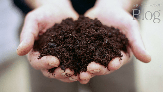 all starts with the land”.
I don’t know who first spoke that oft quoted phrase but it’s a basic and critical fact in real estate. In my world, selling land and farms and managing development projects, land – and more specifically soil – is a critical attribute of the properties I deal with.
Soil is the upper layer of earth that may dug or plowed and in which plants grow. At the most basic level soil is composed of four components: minerals, water, air and organic matter. The exact composition of these components determines the quality of the soil, which in turn goes a long way in determining the potential uses and market value of a given parcel of land.
One of the main tools available to help land users determine the potentials and limitations of soils is a soil survey. The US Department of Agriculture (USDA) publishes soil surveys, which aid farmers and other land users in understanding their soils.
While the USDA has identified more than 20,000 unique soil descriptions, they also group these unique soil series into “Capability Classes” which broadly describe the ability of the soils to be used for agricultural production.
The Capability Classes are designated by numbers from 1 through 8. Lower numbers have fewer limitations for agricultural production.
- On the most basic level higher classification soils have deep, rich soils which can support a wide variety of crops so the land owner will typically grow the a crop that has the highest market value.
- Lower capability soils aren’t as suitable for growing crops and will often be used for pasturing animals
- The lowest capability soils are often left fallow and eventually become forest.
Note: Locally, Middletown valley and the southern Frederick valley are two areas which have high proportions of Class 1 and 2 soils.
In addition to soil Capability Classes the USDA soil survey includes data and ratings on dozens of disparate subjects including erosion hazards, corrosion of concrete and steel, suitability for natural surface roads, yields for specific crops, and septic tank absorption fields. The USDA has done a fantastic job in keeping up with technology and current soil surveys are now available on the internet – search for “web soil survey” and have fun exploring.
Other maps are used to determine where development is appropriate (and economical). In Frederick County, maps showing FEMA floodplain, wetlands, flooding soils, wet soils, and restricted soils (if individual septic systems are planned) are all critical.
These maps can limit where development is allowed, whether houses with basements are allowed, and when percolation testing may be performed.
It’s important to remember that the maps are guides that are prepared at broad levels – the level of detail may not be accurate for any exact location.
The maps do not replace careful onsite investigation or analysis by a qualified soil scientist – if a soil scientist is able to document that the map is incorrect then the map can be changed.
If you are interested in discussing the soils on a property you own, or are considering acquiring, please feel free to contact me.
Dave Wilkinson, Vice President, joined MacRo as Director of Marketing in 1992, and has served as Vice President since 1997. Dave holds a B.S. and M.A. in Economics from the University of Delaware. Dave is a licensed Realtor and brokers and handles most of MacRo’s land and farm deals.